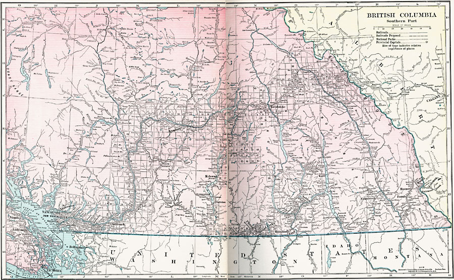
Description: A map from 1920 of the southern part of the province of British Columbia. The map shows the provincial capital of Victoria, major cities and towns, existing and proposed railways, lakes, and rivers of this portion of the province. The grid used by the Dominion Land Survey shows the extent of the surveyed land at the time due to the mountainous terrain.
Place Names: Canada, Vancouver, �Victoria, �Chilliwack, �Ladysmith, �Nanaimo, �Esquimalt, �Kamloops, �Kelowna, �Grand Forks, �Michel, �Hosmer, �Cranbrook,
ISO Topic Categories: boundaries,
inlandWaters,
location,
transportation,
environment
Keywords: Southern British Columbia, physical, �transportation, physical features, railroads, boundaries,
inlandWaters,
location,
transportation,
environment, Unknown, 1920
Source: , Hammond's Modern Atlas of the World (New York, NY: C. S. Hammond and Company, Inc., 1920) 14-15
Map Credit: Courtesy the private collection of Roy Winkelman |
|