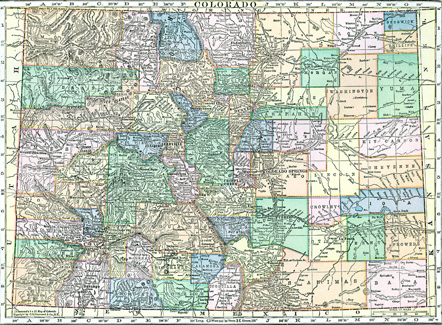
Description: A map from 1920 of Colorado showing the State capital of Denver, counties and county seats, major cities and towns, railroads, the Rockies and other mountain systems, lakes, and rivers.
Place Names: Colorado, Denver, �Georgetown, �Leadville, �Colorado Springs, �Pueblo, �Central City, �Greele
ISO Topic Categories: boundaries,
location,
inlandWaters
Keywords: Colorado, physical, �political, physical features, county borders, boundaries,
location,
inlandWaters, Unknown, 1920
Source: , Hammond's Modern Atlas of the World (New York, NY: C. S. Hammond and Company, Inc., 1920) 107
Map Credit: Courtesy the private collection of Roy Winkelman |
|