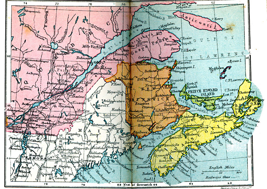
Description: A map from 1920 of the Canadian Maritime Provinces of New Brunswick, Nova Scotia, and Prince Edward Island, and the southern portion of Quebec from Montreal to the Gulf of St. Lawrence and Anticosti Island. The map shows the provincial capitals of Fredericton (New Brunswick), Halifax (Nova Scotia), and Charlottetown (Prince Edward Island), major cities, towns, and ports, railways, coastal features and smaller islands.
Place Names: Canada, Prince Edward Island, �Nova Scotia, �New Brunswick, �Gaspe Peninsula, �Quebe
ISO Topic Categories: boundaries,
inlandWaters,
location,
oceans,
transportation
Keywords: Maritime Provinces and Quebec, physical, �political, �transportation, physical features, country borders,
major political subdivisions, railroads, boundaries,
inlandWaters,
location,
oceans,
transportation, Unknown, 1920
Source: , Asprey's Atlas of the World (London, England: Asprey and Co., Ltd., 1920) 126
Map Credit: Courtesy the private collection of Roy Winkelman |
|