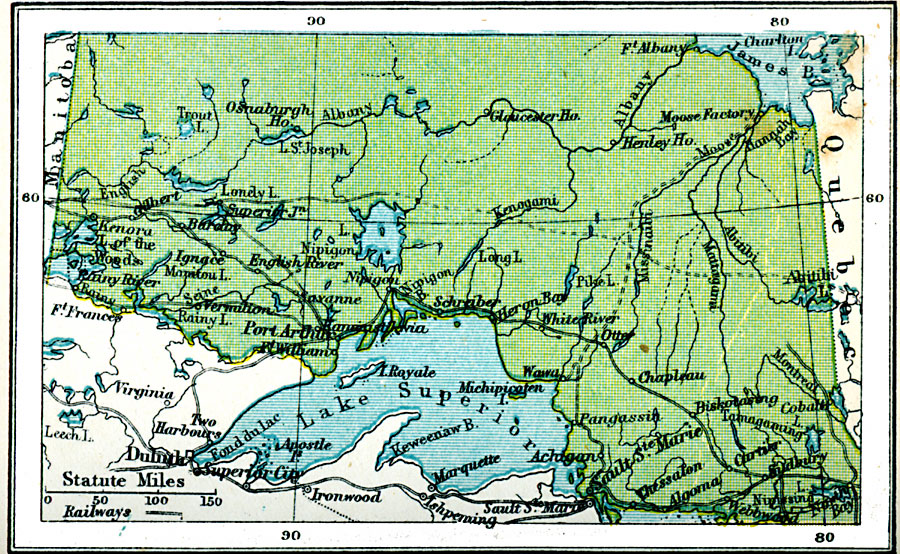
Description: A map from 1920 of northern Ontario showing major cities and towns, existing and proposed railways, lakes, and rivers of the area. Map coverage is from James Bay on Hudson Bay to Lake Superior, and from the border of Manitoba to the boarder of Quebec.
Place Names: Canada, Port Arthur, �Albany, �Sault St. Mari
ISO Topic Categories: boundaries,
inlandWaters,
location,
transportation
Keywords: Northern Ontario, physical, �political, �transportation, physical features, country borders,
major political subdivisions, railroads, boundaries,
inlandWaters,
location,
transportation, Unknown, 1920
Source: , Asprey's Atlas of the World (London, England: Asprey and Co., Ltd., 1920) 127
Map Credit: Courtesy the private collection of Roy Winkelman |
|