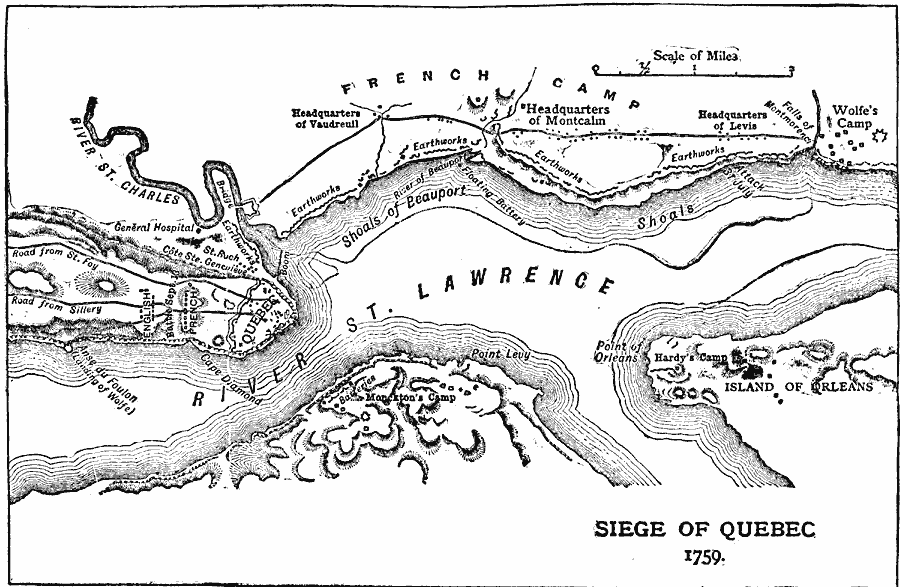
Description: A map of the vicinity of Quebec showing important sites during the British siege and capture of the city in 1759, including the city walls and earthworks, the French camps and field headquarters of Montcalm and Vaudreuil, the field hospital on the banks of the St. Charles where Montcalm died, the British camps of Wolfe near the Falls of Montmorency, Hardy on the Island of Orleans, and Monckton near Point Levy, the landing point of Wolfe below the Plains of Abraham, and the troop positions on September 13 and the fall of Quebec.
Place Names: Canada, Quebe
ISO Topic Categories: oceans,
location,
inlandWaters
Keywords: Siege of Quebec 1759, borders, �political, �historical, country borders, historical event, oceans,
location,
inlandWaters, Unknown, 1759
Source: Chandler B. Beach, A.M. (ed.), The New Student's Reference Work for Teachers, Students, and Families (vol. III) (Chicago, IL: F.E. Compton and Co. , 1909) 1573
Map Credit: Courtesy the private collection of Roy Winkelman |
|