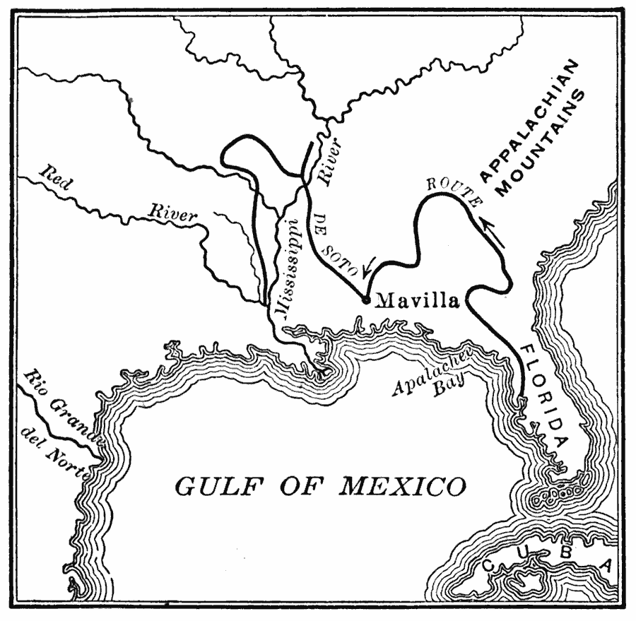
Description: A map of the supposed route of Hernando de Soto's expedition from Tampa Bay (1539) to the Mississippi River, first reached in 1541, and the site of his death in 1542. This map, from 1907, shows a route that has been disputed in later years.
Place Names: Early America 1400-1800, Miami, �New Orleans, �Spanish, �Discover
ISO Topic Categories: oceans,
location,
inlandWaters
Keywords: The Route of DeSoto, borders, �historical, country borders, historical event, oceans,
location,
inlandWaters, Unknown, 1539–1542
Source: Gertrude van Duyn Southworth, A First Book in American History (New York, NY: D. Appleton and Co. , 1907) 22
Map Credit: Courtesy the private collection of Roy Winkelman |
|