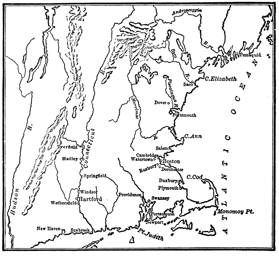
Description: A map of the New England region showing the chief early European settlements between 1620–1675. The map shows rivers, terrain and coastal features, the coastal settlements of Pemaquid, Saco, Dover, Portsmouth, Salem, Cambridge, Watertown, Boston, Roxbury, Dorchester, Duxbury, Plymouth, Newport, Portsmouth, Swanzey, Providence, Saybrook, New Haven, and the interior settlements of Deerfield, Hadley, Springfield, Windsor, Hartford, and Wethersfield along the Connecticut River.
Place Names: Early America 1400-1800, Boston, �Cambridge, �Hartford, �New Haven, �Portsmouth, �New England, �Colonial Americ
ISO Topic Categories: oceans,
location,
inlandWaters
Keywords: The Chief Settlements made in New England, borders, country borders, oceans,
location,
inlandWaters, Unknown, 1620–1675
Source: Gertrude van Duyn Southworth, A First Book in American History (New York, NY: D. Appleton and Co. , 1907) 60
Map Credit: Courtesy the private collection of Roy Winkelman |
|