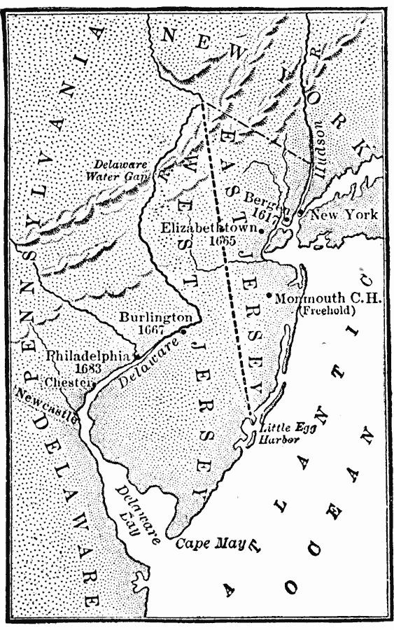
Description: A map of New Jersey and eastern Pennsylvania showing the early European settlements in the area from Bergen, New Jersey established in 1617 to Philadelphia, Pennsylvania, established in 1683. The map shows the boundary between West New Jersey and East New Jersey established in 1676 (unified under the governor of New York in 1702), and the settlements of Elizabethtown, Monmouth Courthouse (Freehold), Burlington, Chester, and Newcastle.
Place Names: Early America 1400-1800, Bergen, �Elizabethtown, �Monmouth, �New Jersey, �Pennsylvania, �Philadelphia, �Colonial America, �Discover
ISO Topic Categories: oceans,
location,
inlandWaters
Keywords: The Early European Settlements of Pennsylvania and New Jersey, borders, country borders, oceans,
location,
inlandWaters, Unknown, 1617–1683
Source: Gertrude van Duyn Southworth, A First Book in American History (New York, NY: D. Appleton and Co. , 1907) 106
Map Credit: Courtesy the private collection of Roy Winkelman |
|