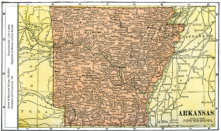
Description: A map of Arkansas from 1904 showing the State capital of Little Rock, major cities and towns, railroads, mountains, and rivers. The map notes the area in square miles (53,850), number of counties (75), and the population at the time (1,311,564).
Place Names: Arkansas, Benton, �Clinton, �Fayetteville, �Fort Smith, �Helena, �Hot Springs, �Jonesboro, �Little Rock, �Pine Bluff, �Texarkan
ISO Topic Categories: oceans,
location,
inlandWaters
Keywords: Arkansas, borders, �statistical, population, oceans,
location,
inlandWaters, Unknown, 1904
Source: George Edwin Rines, ed., The United Editors Perpetual Encyclopedia (New York, NY: United Editors Association, 1911)
Map Credit: Courtesy the private collection of Roy Winkelman |
|