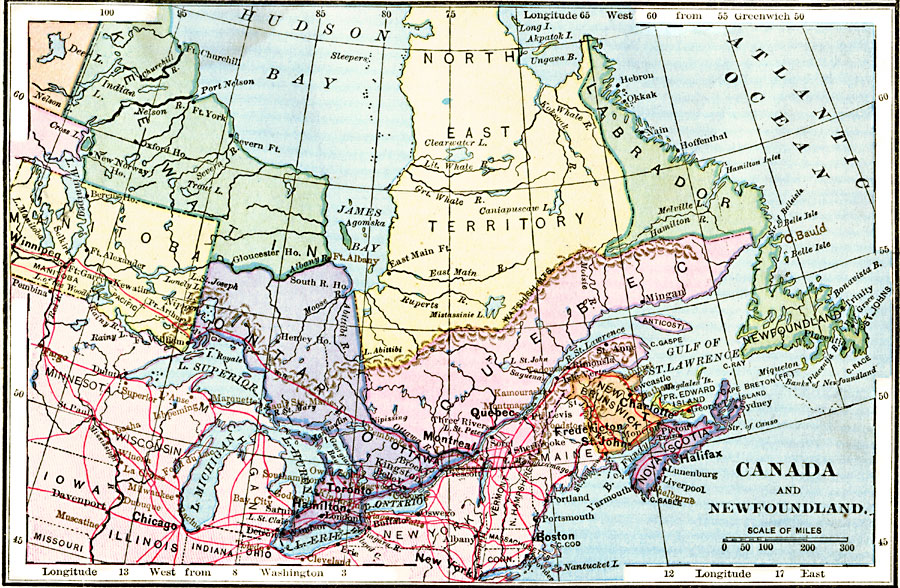
Description: A map from 1883 of the eastern part of Canada showing the political boundaries at the time, the capital and provincial capitals, major cities and towns, railways, mountains, lakes, rivers, coastal features, and islands. The territories shown are Keewatin, Manitoba, Ontario, Northeast Territory, Quebec, New Brunswick, Prince Edward Island, Nova Scotia, Newfoundland and Labrador. Longitude from Greenwich is shown at the top of the map, and from Washington at the bottom.
Place Names: Canada, Toronto, �Winnipeg, �Quebec, �Montreal, �Ottawa, �Newfoundland,
ISO Topic Categories: boundaries,
location,
inlandWaters,
oceans,
transportation
Keywords: Eastern Canada and Newfoundland, physical, �transportation, physical features, railroads, boundaries,
location,
inlandWaters,
oceans,
transportation, Unknown, 1883
Source: , Handy Atlas of the World (New York, NY: Ivison, Blakeman, Taylor and Co., 1883) 5
Map Credit: Courtesy the private collection of Roy Winkelman |
|