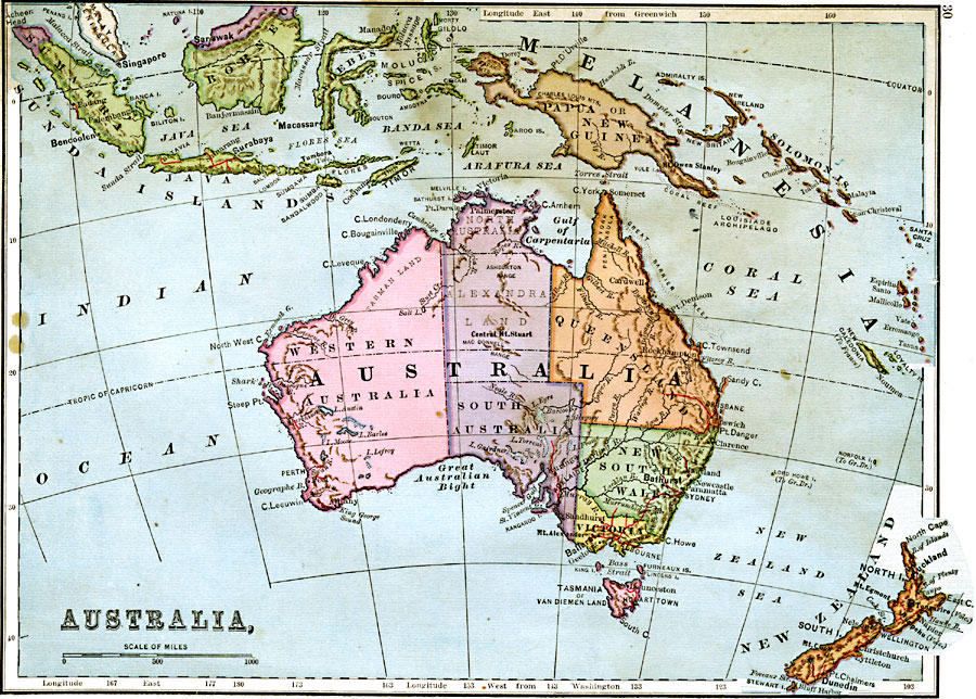
Description: A map from 1883 of Australia and islands of Oceania from Sumatra and Borneo in the north, the Loyalty Islands to the east, and New Zealand to the south. The map shows major cities, railways, rivers, and terrain features.
Place Names: A Complete Map of Australia, Australia, �Papua New Guinea, �Solomon Islands, �New Zealand, �Tasmania, �Van Diemen Land, �Java, �Sumatra, �Sunda Islands, �Borneo, �Celebes, �New Caledonia,
ISO Topic Categories: boundaries,
inlandWaters,
location,
oceans
Keywords: Australia and Islands of Oceania, physical, �political, physical features, country borders, boundaries,
inlandWaters,
location,
oceans, Unknown, 1883
Source: , Handy Atlas of the World (New York, NY: Ivison, Blakeman, Taylor and Co., 1883) 30
Map Credit: Courtesy the private collection of Roy Winkelman |
|