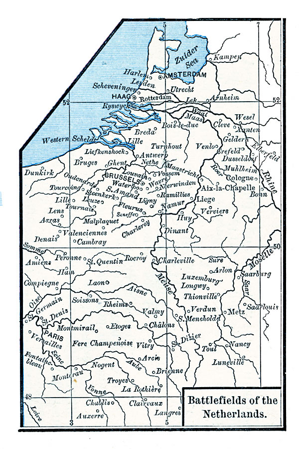
Description: A map of the Netherlands in 1713 at the time of the Treaty of Utrecht showing the battlefields of the Spanish War of Succession. The map shows Liege (1702), Antwerp, Dunkirk, and Ramillies (1706), Oudenarde and Lille (1708), Malplaquet (1709), and Utrecht.
Place Names: Netherlands, Amsterdam, �Brussels,
ISO Topic Categories: oceans,
location,
inlandWaters
Keywords: Battlefields of the Netherlands, borders, �historical, country borders, other military, oceans,
location,
inlandWaters, Unknown, 1713
Source: Robert H. Labberton, New Historical Atlas and General History (New York, NY: Townsend MacCoun, 1886) Plate XLVII
Map Credit: Courtesy the private collection of Roy Winkelman |
|