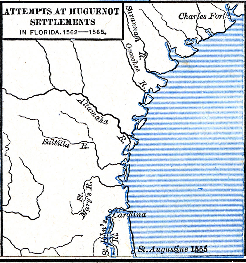
Description: A map of the southern Atlantic coastline showing the early attempts by the French Huguenots under Jean Ribault to establish settlements in the Spanish territory of Florida. The map shows the sites of Charles Fort (Charlesfort) South Carolina, a short–lived colony (1562–1563), and Carolina (Fort Caroline) at the mouth of the St. Johns River, Florida. The map also shows St. Augustine, established in 1565 under Don Pedro Menéndez de Avilés as a defensive settlement against French colonization in the Spanish territory.
Place Names: Early America 1400-1800, St. Augustine, �Discovery, �Frenc
ISO Topic Categories: oceans,
location,
inlandWaters
Keywords: Attempts at Huguenot Settlements in Florida, borders, oceans,
location,
inlandWaters, Unknown, 1562–1565
Source: Robert H. Labberton, New Historical Atlas and General History (New York, NY: Townsend MacCoun, 1886) Plate LVIII
Map Credit: Courtesy the private collection of Roy Winkelman |
|