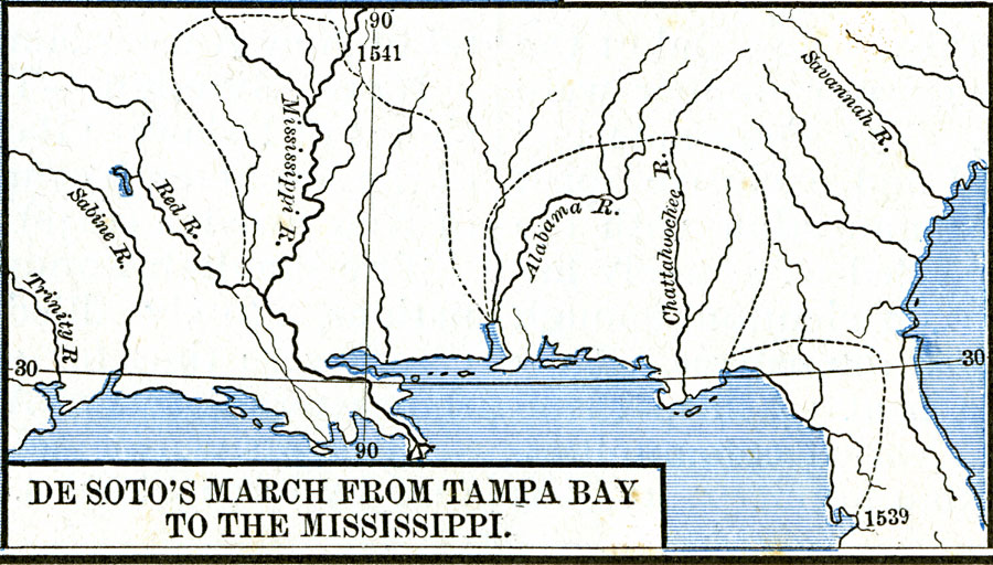
Description: A map of the route of Hernando de Soto's expedition taken from Tampa Bay (1539) to the Mississippi River, first reached in 1541, and the site of his death in 1542. This map, from 1891, shows a route that has been disputed in later years.
Place Names: Early America 1400-1800, Alabama, �Florida, �Mississippi, �Spanish, �Discover
ISO Topic Categories: oceans,
location,
inlandWaters
Keywords: DeSoto's March from Tampa Bay to the Mississippi, borders, �historical, historical event, oceans,
location,
inlandWaters, Unknown, 1539–1542
Source: Robert H. Labberton, New Historical Atlas and General History (New York, NY: Townsend MacCoun, 1886) Plate LIX
Map Credit: Courtesy the private collection of Roy Winkelman |
|