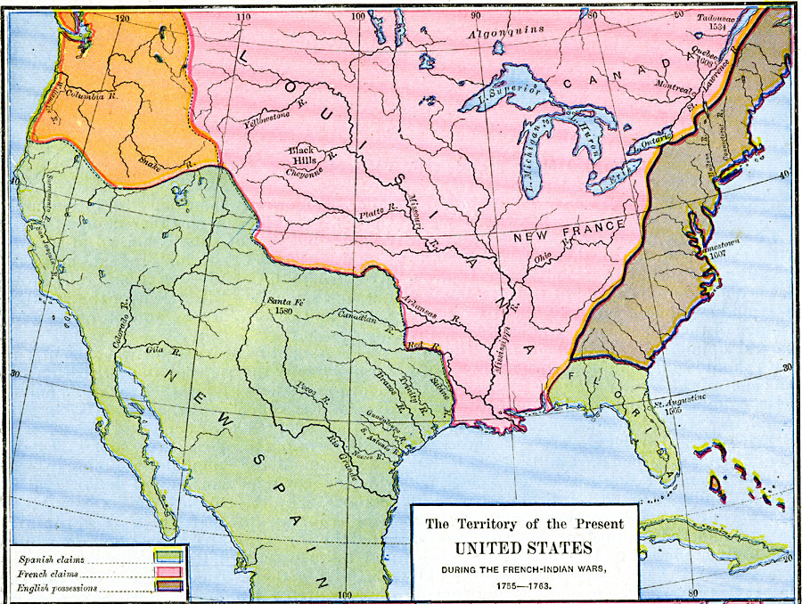
Description: A map of North America showing the foreign possessions in the area of the present United States during the French and Indian Wars (1755–1763) between the French and English. This map is color–coded to show territorial claims at the time of the Spanish, French, and the English, including the East Coast from Georgia to Acadia, the Bahamas, and the Oregon Country. The map also notes the dates of settlement by the Spanish in St. Augustine (1565) and Santa Fé (1580), the French in Tadousac (1534) and Quebec (1608), and the English at Jamestown (1607).
Place Names: Early America 1400-1800, Canada, �United State
ISO Topic Categories: oceans,
location,
inlandWaters
Keywords: The Territory of the Present United States during the French-Indian Wars, borders, oceans,
location,
inlandWaters, Unknown, 1755–1763
Source: Robert H. Labberton, New Historical Atlas and General History (New York, NY: Townsend MacCoun, 1886) Plate LXIII
Map Credit: Courtesy the private collection of Roy Winkelman |
|