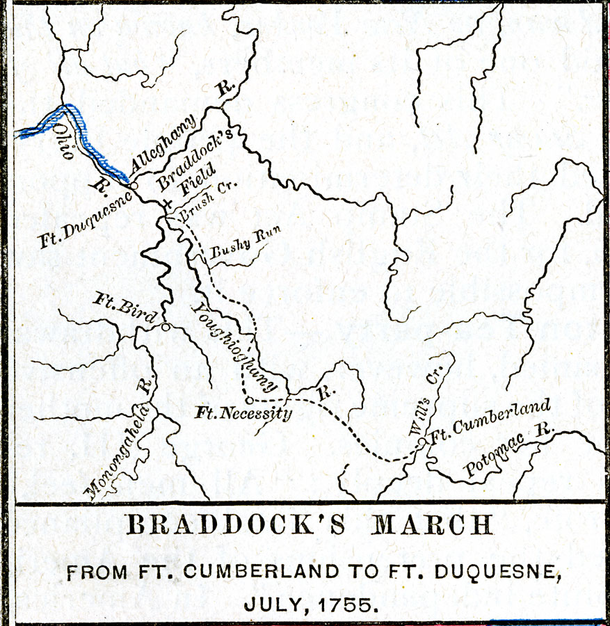
Description: A map showing British General Braddock's March from Ft. Cumberland to Ft. Duquesne in July, 1755. At the time of the French and Indian War, Fort Duquesne (now Pittsburgh), held by the French, was a strategic point where the Allegheny and Monongahela rivers join to form the Ohio River, essential for controlling the Ohio Country west of the Allegheny Mountains. The map show the route taken by Braddock from the Potomac toward Fort Duquesne, and Braddock's Field, the site where the French and Indian allies repelled the British.
Place Names: Early America 1400-1800, Virginia, �French, �Native Americans, �French and Indian War, �Englis
ISO Topic Categories: oceans,
location,
inlandWaters
Keywords: Braddock's March from Ft. Cumberland to Ft. Duquesne, borders, �historical, historical event, oceans,
location,
inlandWaters, Unknown, July 1755
Source: Robert H. Labberton, New Historical Atlas and General History (New York, NY: Townsend MacCoun, 1886) Plate LXIII
Map Credit: Courtesy the private collection of Roy Winkelman |
|