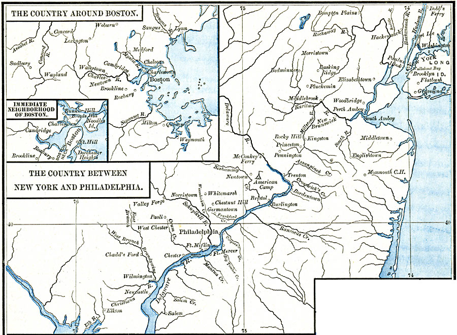
Description: A series of maps showing the country around Boston, the immediate vicinity of Boston, and the country between New York City and Philadelphia during the American Revolutionary War period. These maps show cities and towns, forts, rivers, and important sites during the war.
Place Names: Early America 1400-1800, Delaware, �New Jersey, �New York, �Pennsylvania, �Vermont, �American Revolutio
ISO Topic Categories: oceans,
location,
inlandWaters
Keywords: Areas of the Northern American Revolutionary War, borders, �historical, kAmericanRevolution, American Revolution, oceans,
location,
inlandWaters, Unknown, 1775–1783
Source: Robert H. Labberton, New Historical Atlas and General History (New York, NY: Townsend MacCoun, 1886) Plate LXV
Map Credit: Courtesy the private collection of Roy Winkelman |
|