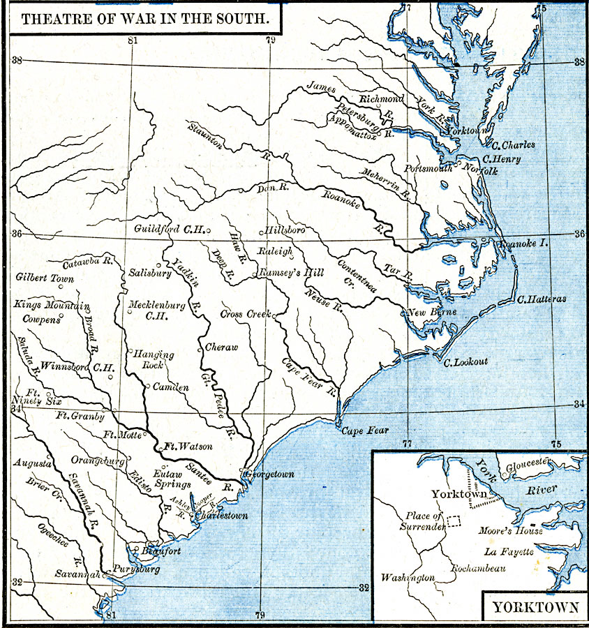
Description: A map of the southern theater of the American Revolutionary War from the Chesapeake Bay south to Savannah, showing major cities and towns, forts, and important battle sites of the period. An inset map details Yorktown, site of the final battle of the war, the Moore House where conditions of surrender were discussed, and the site where Cornwallis surrendered to Washington.
Place Names: Early America 1400-1800, Georgia, �North Carolina, �South Carolina, �Virginia, �American Revolutio
ISO Topic Categories: oceans,
location,
inlandWaters
Keywords: Theatre of the American Revolutionary War in the South, borders, kAmericanRevolution, oceans,
location,
inlandWaters, Unknown, 1775–1783
Source: Robert H. Labberton, New Historical Atlas and General History (New York, NY: Townsend MacCoun, 1886) Plate LXV
Map Credit: Courtesy the private collection of Roy Winkelman |
|