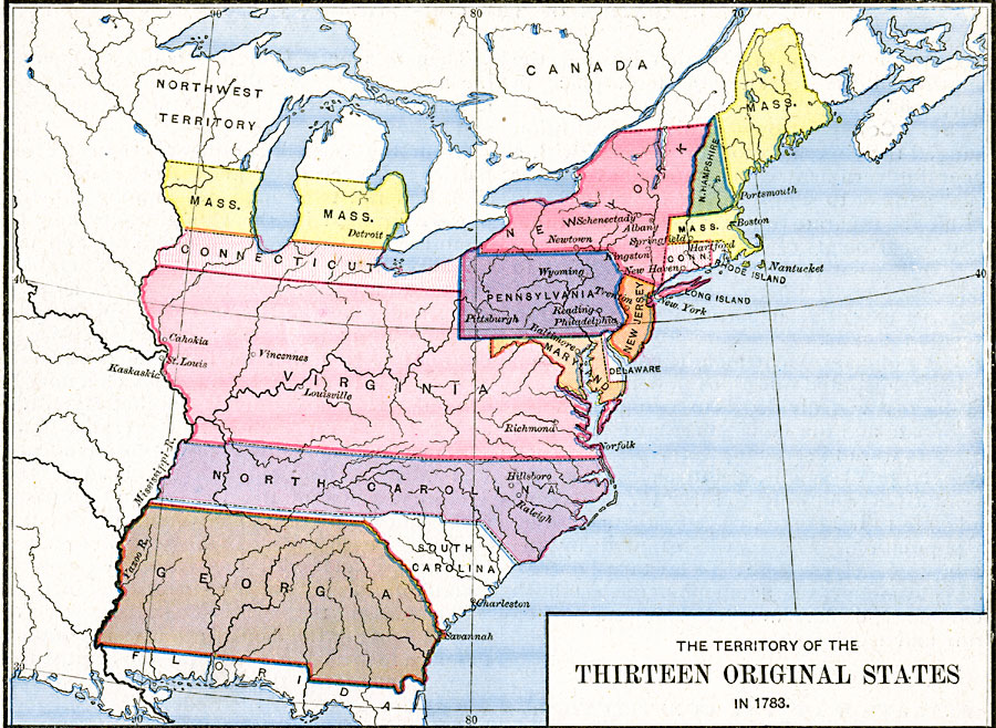
Description: A map of the United States at the close of the American Revolutionary War (1783) showing the newly formed States, and their claims to the lands west of the Allegheny Mountains to the Mississippi River.
Place Names: Early America 1400-1800, Georgia, �Maryland, �Massachusetts, �New Hampshire, �New Jersey, �New York, �North Carolina, �Pennsylvania, �Rhode Island, �Virginia, �Treaty of 1783, �American Revolutio
ISO Topic Categories: oceans,
location,
inlandWaters
Keywords: The Territory of the Thirteen Original States, borders, oceans,
location,
inlandWaters, Unknown, 1783
Source: Robert H. Labberton, New Historical Atlas and General History (New York, NY: Townsend MacCoun, 1886) Plate LXVI
Map Credit: Courtesy the private collection of Roy Winkelman |
|