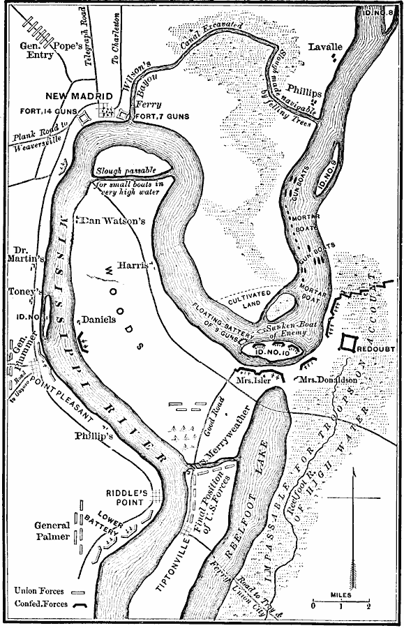
Description: A map of the vicinity of New Madrid and Island Number 2 along the Mississippi River in 1862 during the American Civil War. The map shows Union and Confederate positions, gun boats, batteries, redoubts, and forts, with map notes of terrain and waterway barriers to troop movements in the area.
Place Names: Missouri, New Madri
ISO Topic Categories: location,
inlandWaters,
transportation,
structure,
intelligenceMilitary
Keywords: New Madrid, physical, �transportation, �historical, physical features, roads, Civil War, location,
inlandWaters,
transportation,
structure,
intelligenceMilitary, Unknown, 1862
Source: E. Benjamin Andrews, History of the United States Vol IV (New York, NY: Charles Scribner's Sons, 1895) 27
Map Credit: Courtesy the private collection of Roy Winkelman |
|