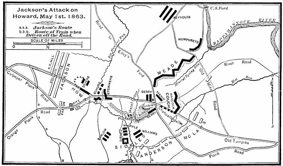
Description: A map of the vicinity of Chancellorville showing Jackson's Attack on Howard, May 1st, 1863.
Place Names: Civil War, Chancellorsville,
ISO Topic Categories: boundaries,
inlandWaters,
location,
intelligenceMilitary,
transportation
Keywords: Jackson's Attack on Howard near Chancellorville, historical, �transportation, �physical, kBattle, physical features, roads, Civil War, boundaries,
inlandWaters,
location,
intelligenceMilitary,
transportation, Unknown, May 1, 1863
Source: E. Benjamin Andrews, History of the United States Vol IV (New York, NY: Charles Scribner's Sons, 1895) 95
Map Credit: Courtesy the private collection of Roy Winkelman |
|