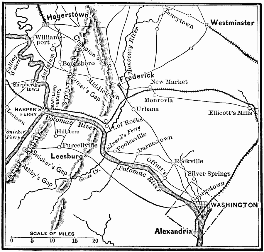
Description: A map of the area of the northern Valley Campaign (1864) under Confederate General Jubal Anderson Early from Harper's Ferry to Washington. The map shows the general locations of the Battle of Monocacy Junction (July 9), Battle of Fort Stevens on the perimeter of Washington (July 11–12), Purcellville (July 16), and Snicker's Ferry (July 17).
Place Names: Civil War, Hagerston, �Westminster, �Leesburg, �Frederick Cit
ISO Topic Categories: transportation,
location,
inlandWaters
Keywords: General Early's Maryland Campaign, physical, �transportation, �historical, physical features, railroads,
roads, Civil War, transportation,
location,
inlandWaters, Unknown, 1864
Source: E. Benjamin Andrews, History of the United States Vol IV (New York, NY: Charles Scribner's Sons, 1895) 117
Map Credit: Courtesy the private collection of Roy Winkelman |
|