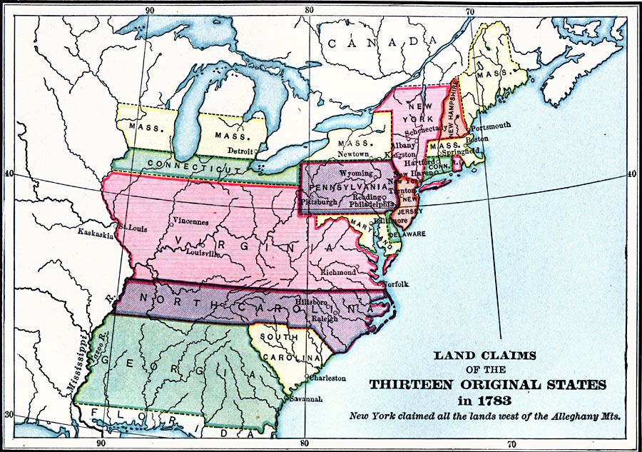
Description: A map of eastern North America showing the land claims of the thirteen original states in 1783, from the Atlantic coast west to the Mississippi River. The map notes that New York claimed all the lands west of the Alleghany mountains. State boundaries, major cities and settlements, and rivers are shown.
Place Names: Early America 1400-1800, Philadelphia, �Savannah, �Trenton, �Baltimore, �Springfield, �Hartford, �New York, �Colonial Americ
ISO Topic Categories: inlandWaters,
location,
oceans,
boundaries
Keywords: Land Claims of the Colonies, physical, �political, �historical, physical features, country borders,
major political subdivisions, inlandWaters,
location,
oceans,
boundaries, Unknown, 1783
Source: Charles Kendall Adams, A History of the United States (Boston, MA: Allyn and Bacon, 1909) 179
Map Credit: Courtesy the private collection of Roy Winkelman |
|