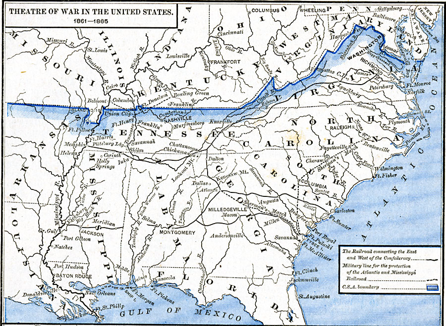
Description: A map showing the extent of the Confederate territories east of the Mississippi River during the American Civil War (1861–1865). The map shows state lines and capitals, major cities, forts, battle sites, and rivers in the region. The map shows the railroad network connecting the East and the West portions of the Confederacy, and the military line used for the protection of the Atlantic and Mississippi Railroad. The march of General Sherman from Atlanta to Savannah, then north to Bentonville and Raleigh is shown.
Place Names: Civil War, Alabama, �Arkansas, �Florida, �Georgia, �Illinois, �Indiana, �Kentucky, �Louisiana, �Maryland, �Missouri, �North Carolina, �South Carolina, �Tennessee, �West Virginia, �Theatre of Wa
ISO Topic Categories: oceans,
location,
inlandWaters,
boundaries
Keywords: Theatre of War in the United States, borders, �historical, �transportation, country borders, railroads, other military,
Civil War, oceans,
location,
inlandWaters,
boundaries, Unknown, 1861–1865
Source: Robert H. Labberton, New Historical Atlas and General History (New York, NY: Townsend MacCoun, 1886) Plate LXXI
Map Credit: Courtesy the private collection of Roy Winkelman |
|