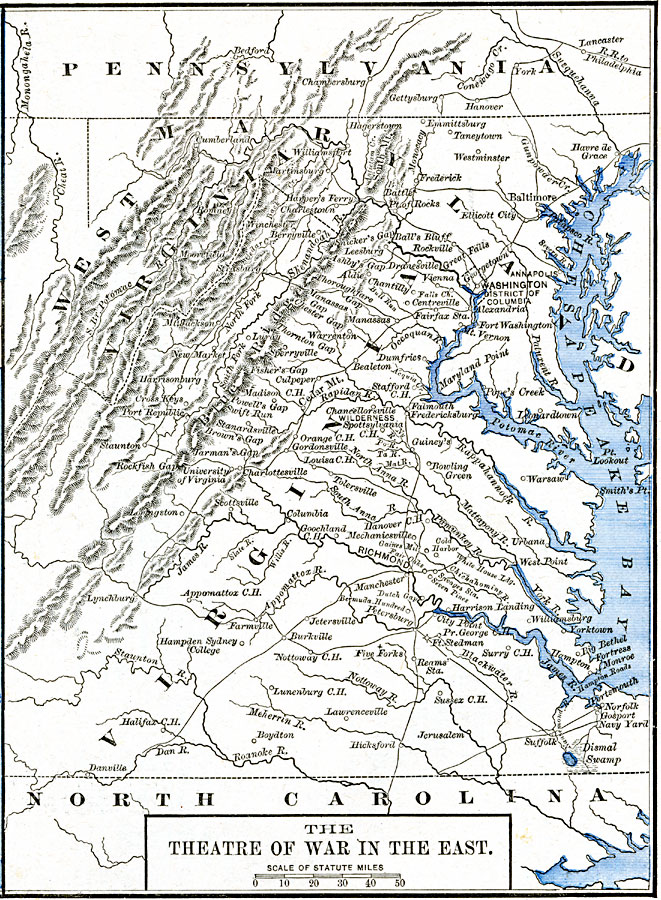
Description: A map of the eastern seat of war during the American Civil War, showing cities, railroads, mountains and terrain, forts, rivers, and significant battle sites.
Place Names: Civil War, Maryland, �North Carolina, �Pennsylvania, �Virginia, �Washington D.C., �West Virginia, �Theatre of Wa
ISO Topic Categories: oceans,
location,
inlandWaters,
boundaries
Keywords: Theatre of War in the East, borders, �historical, country borders, other military,
Civil War, oceans,
location,
inlandWaters,
boundaries, Unknown, 1861–1865
Source: Robert H. Labberton, New Historical Atlas and General History (New York, NY: Townsend MacCoun, 1886) Plate LXXI
Map Credit: Courtesy the private collection of Roy Winkelman |
|