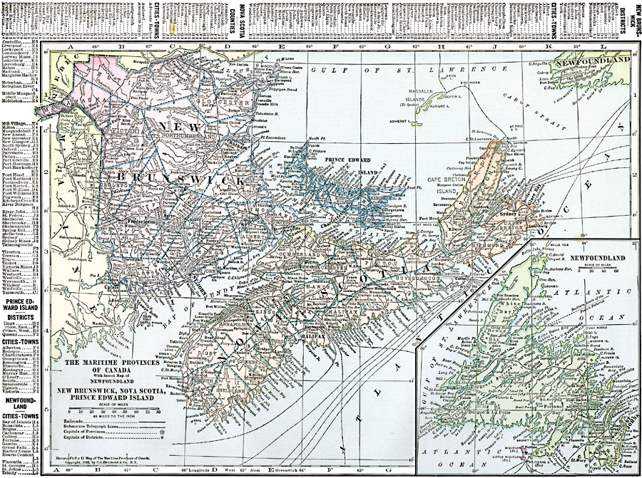
Description: A map from 1920 of the Maritime Provinces of Canada, including New Brunswick, Nova Scotia, and Prince Edward Island. The map shows the county divisions and capitals, the provincial capitals of Fredericton (New Brunswick), Halifax (Nova Scotia), and Charlottetown (Prince Edward Island), major cities, towns, and ports, railways, submarine telegraph routes, coastal features and smaller islands. An inset map details Newfoundland, and includes the French possessions of Miquelon, Little Miquelon, and St. Pierre Island. A grid–key in the margin references the locations of principal cities and towns, and the counties of the three provinces and Newfoundland.
Place Names: Canada, New Brunswick, �Halifax, �Nova Scotia, �Prince Edward Islan
ISO Topic Categories: oceans,
location,
inlandWaters
Keywords: The Maritime Provinces of Canada, borders, �political, �transportation, country borders, railroads, oceans,
location,
inlandWaters, Unknown, 1920
Source: , The New Reference Atlas of the World - A New Series of Physical, Political and Historical Maps compiled from Government Surveys and exhibiting the Latest Results of Geographical Research (New York, NY: C. S. Hammond & Company, 1920) 4
Map Credit: Courtesy the private collection of Roy Winkelman |
|