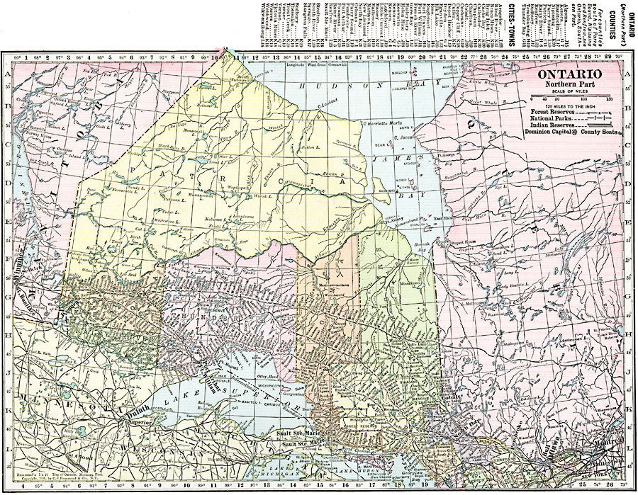
Description: A map from 1920 of the northern part of the province of Ontario. The map shows the capital of Ottawa, major cities and towns, existing and proposed railways, county boundaries, forest reserve boundaries, national park boundaries, Indian reserve boundaries, lakes, the watershed division line, and rivers of this portion of the province. The latitude and longitude grid is shown at one degree increments. A grid–key in the margins references the locations of principal cities and towns, and the counties and divisions of Ontario.
Place Names: Canada, Ontari
ISO Topic Categories: oceans,
location,
inlandWaters
Keywords: Ontario (Northern Part), borders, �political, country borders,
county borders, oceans,
location,
inlandWaters, Unknown, 1920
Source: , The New Reference Atlas of the World - A New Series of Physical, Political and Historical Maps compiled from Government Surveys and exhibiting the Latest Results of Geographical Research (New York, NY: C. S. Hammond & Company, 1920) 10
Map Credit: Courtesy the private collection of Roy Winkelman |
|