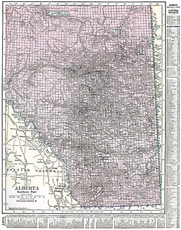
Description: A map from 1920 of the southern part of the province of Alberta. The map shows the provincial capital of Edmonton, major cities and towns, existing and proposed railways, lakes, and rivers of this portion of the province. The grid used by the Dominion Land Survey is shown. A grid–locater key in the margins of the map help locate the electoral districts, cities and towns of Alberta.
Place Names: Canada, Alberta, �Calgary, �Camrose, �Castor, �Coleman, �Edmonton, �Lethbridge, �Medicine Hat, �Red Deer, �Tabe
ISO Topic Categories: oceans,
location,
inlandWaters
Keywords: Alberta, borders, �political, country borders,
county borders, oceans,
location,
inlandWaters, Unknown, 1920
Source: , The New Reference Atlas of the World - A New Series of Physical, Political and Historical Maps compiled from Government Surveys and exhibiting the Latest Results of Geographical Research (New York, NY: C. S. Hammond & Company, 1920) 13
Map Credit: Courtesy the private collection of Roy Winkelman |
|