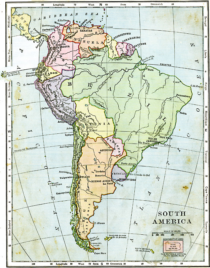
Description: A map of South America from 1906 showing the political boundaries of the time. The map shows capitals, major cities, ports, rivers, terrain and coastal features. An outline map of Pennsylvania at the same map scale is included to show the comparative area size relationship, and latitudinal references to world locations (Hindustan, Malay Peninsula, New Guinea, Australia, New Zealand, Tasmania, Cape Town, Transvaal, Mozambique, Kongo, Liberia, and Senegal) are shown in the margins.
Place Names: A Complete Map of South America, Argentina, �Brazil, �Paraguay, �Bolivia, �Chile, �Uruguay, �Columbia, �Ecuador, �Peru, �Venezuel
ISO Topic Categories: oceans,
inlandWaters,
location,
boundaries
Keywords: South America, physical, �political, kComparativeArea, physical features, country borders, oceans,
inlandWaters,
location,
boundaries, Unknown, 1906
Source: Alexis Everett Frye, Frye's First Steps in Geography (Boston, Massachusetts: Ginn and Company, 1906) 83
Map Credit: Courtesy the private collection of Roy Winkelman |
|