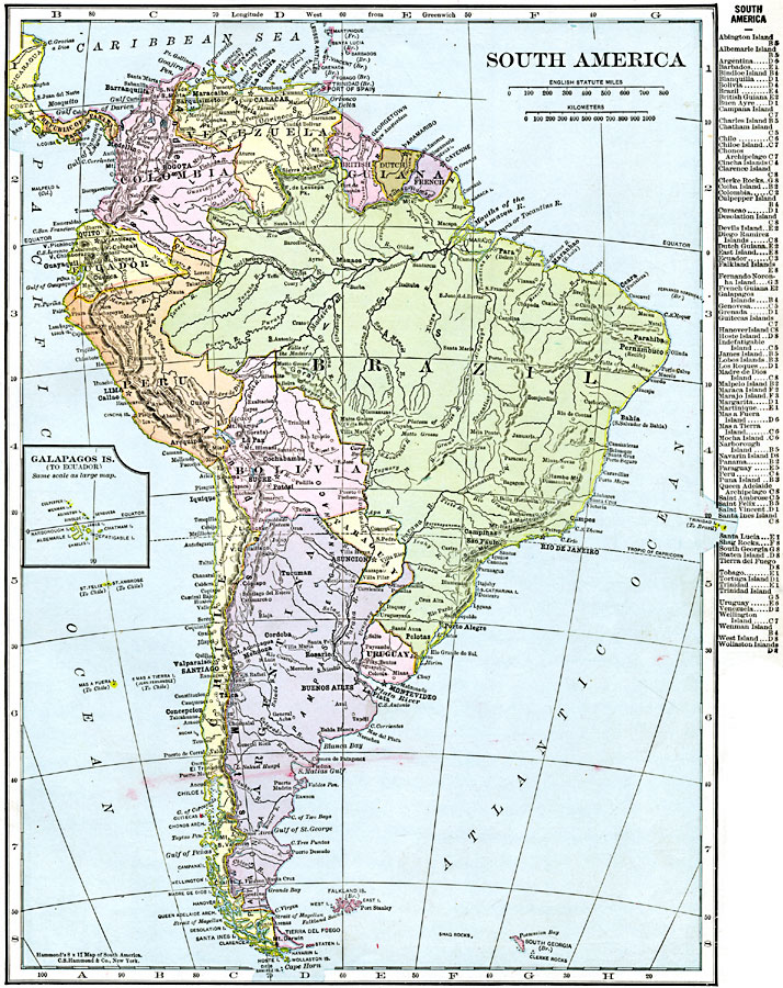
Description: A map of South America from 1920 showing the political boundaries of the time. The map shows capitals, major cities, ports, rivers, and coastal features. An inset map shows the Galapagos Islands. A key–grid reference to countries and islands is given in the margin.
Place Names: A Complete Map of South America, Argentina, �Bogota, �Bolivia, �Brazil, �Buenos Airies, �Caracas, �Chile, �Ecuador, �Guiana, �Lima, �Paraguay, �Peru, �Rio de Janeiro, �Sao Paolo, �Uruguay, �Venezuela,
ISO Topic Categories: oceans,
location,
inlandWaters
Keywords: South America, borders, �political, �transportation, country borders,
county borders, railroads, oceans,
location,
inlandWaters, Unknown, 1920
Source: , The New Reference Atlas of the World - A New Series of Physical, Political and Historical Maps compiled from Government Surveys and exhibiting the Latest Results of Geographical Research (New York, NY: C. S. Hammond & Company, 1920) 23
Map Credit: Courtesy the private collection of Roy Winkelman |
|