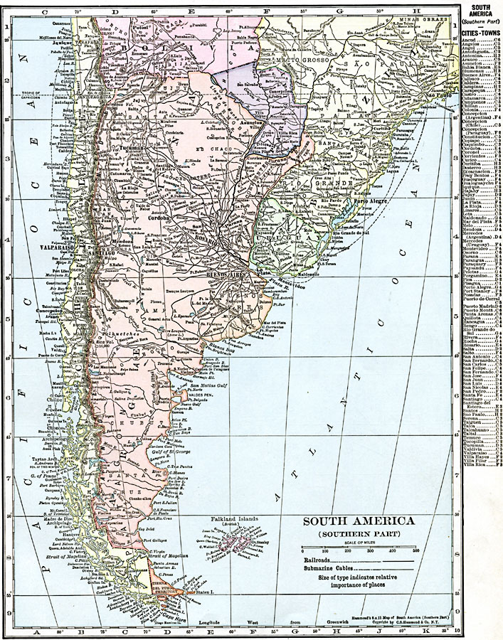
Description: A map from 1920 of the southern part of South America from Sao Paulo on the Atlantic and Iquique on the Pacific south to Tierra del Fuego. The map shows the political boundaries at the time for Argentina, Paraguay, Uruguay, and the southern portions of Chile, Bolivia, and Brazil. Tierra del Fuego is shown as a territory, and the Falkland Islands (Islas Malvinas) as a British possession. The map shows capitals and major cities, towns, ports, railroads, submarine telegraph cables, rivers, terrain, and coastal features. A grid reference key of important cities and towns of the region is given at the side of the map.
Place Names: A Regional Map of South America, Argentina, �Bolivia, �Brazil, �Buenos Airies, �Cape Horn, �Chile, �Falkland Islands, �Paraguay, �Porto Alegre, �Santiago, �Sao Paulo, �Uruguay, �Valparais
ISO Topic Categories: oceans,
location,
inlandWaters
Keywords: South America (Southern Part), borders, �political, �transportation, country borders,
county borders, railroads, oceans,
location,
inlandWaters, Unknown, 1920
Source: , The New Reference Atlas of the World - A New Series of Physical, Political and Historical Maps compiled from Government Surveys and exhibiting the Latest Results of Geographical Research (New York, NY: C. S. Hammond & Company, 1920) 25
Map Credit: Courtesy the private collection of Roy Winkelman |
|