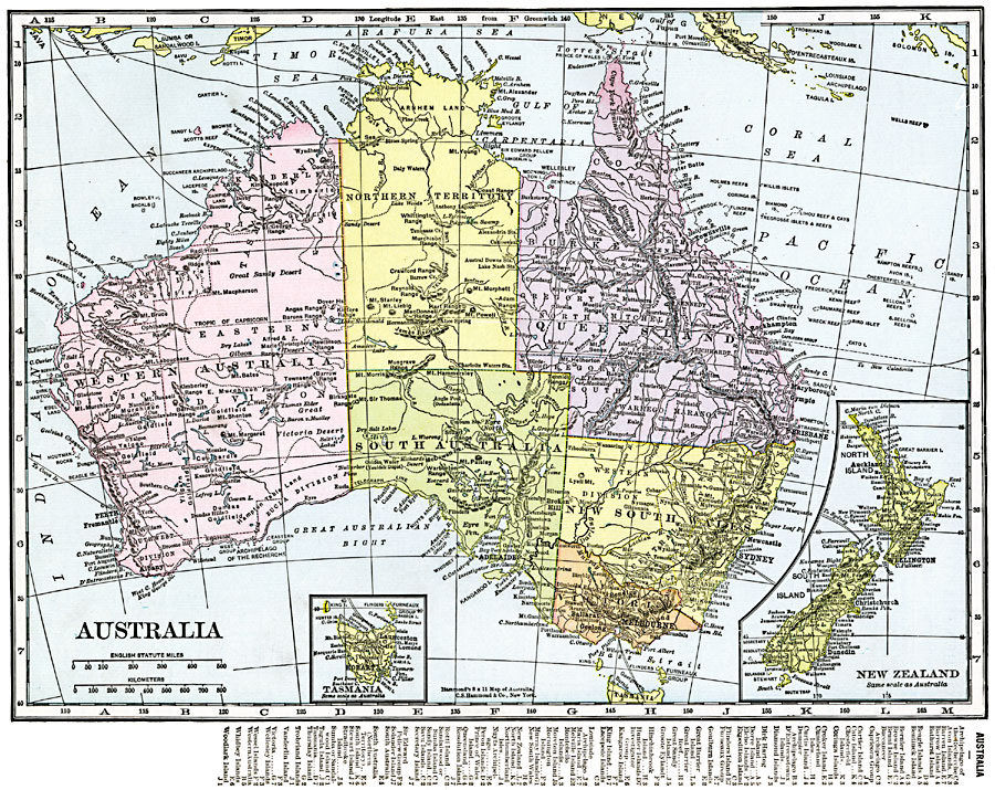
Description: A map of Australia in 1920 showing states and territories, major cities, rivers, mountains, railroads, and steamship routes. Inset maps show Tasmania and New Zealand. This map also has a list of place names with location grid reference on the bottom edge.
Place Names: A Complete Map of Australia, Adelaide, �Alice Springs, �Brisbane, �Cairns, �Canberra, �Darwin, �Mackay, �Melbourne, �Newcastle, �Perth, �Sydney, �Townsville, Hobart, Auckland, Wellington, Christchurch
ISO Topic Categories: oceans,
location,
inlandWaters
Keywords: Australia, borders, �political, country borders,
county borders, oceans,
location,
inlandWaters, Unknown, 1920
Source: , The New Reference Atlas of the World - A New Series of Physical, Political and Historical Maps compiled from Government Surveys and exhibiting the Latest Results of Geographical Research (New York, NY: C. S. Hammond & Company, 1920) 27
Map Credit: Courtesy the private collection of Roy Winkelman |
|