mapsMaps ETC Site map
 Maps ETC > United States > Agriculture > Cotton Production Regions of the United States, 1904
Site Map 

Cotton Production Regions of the United States, 1904

Cotton Production Regions of the United States


Title: Cotton Production Regions of the United States
Projection: Unknown,
Source Bounding Coordinates:
W: -125 E: -67 N: 50 S: 25

Main Map Page
Zoomify Version
B/W PDF Version
Color PDF Version
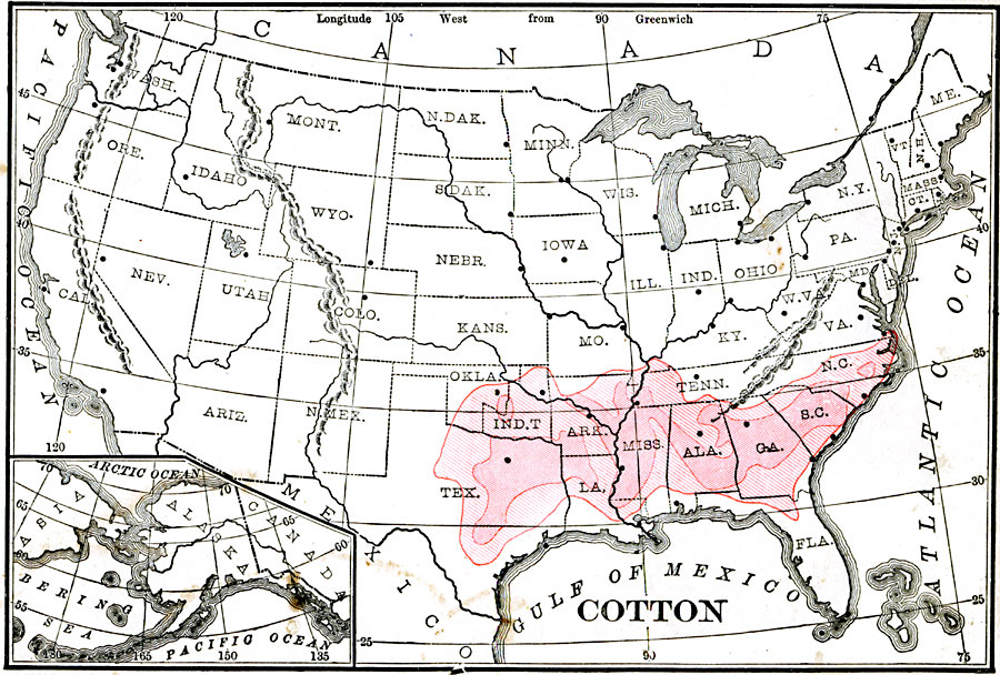
Description: A map from 1904 of the United States showing the principal cotton producing region of the country at the time.
Place Names: Agriculture, cotto
ISO Topic Categories: farming, economy, inlandWaters, location, oceans
Keywords: Cotton Production Regions of the United States, physical, statistical, kAgriculture, physical features, agriculture, farming, economy, inlandWaters, location, oceans, Unknown, 1904
Source: Alexis Everett Frye, Elements of Geography (Boston, MA: Ginn and Company, 1904) 71
Map Credit: Courtesy the private collection of Roy Winkelman
SearchLicensePDF HelpGIS Help Google Earth Help Zoomify Help

 Maps ETC > United States > Agriculture > Cotton Production Regions of the United States, 1904
Site Map