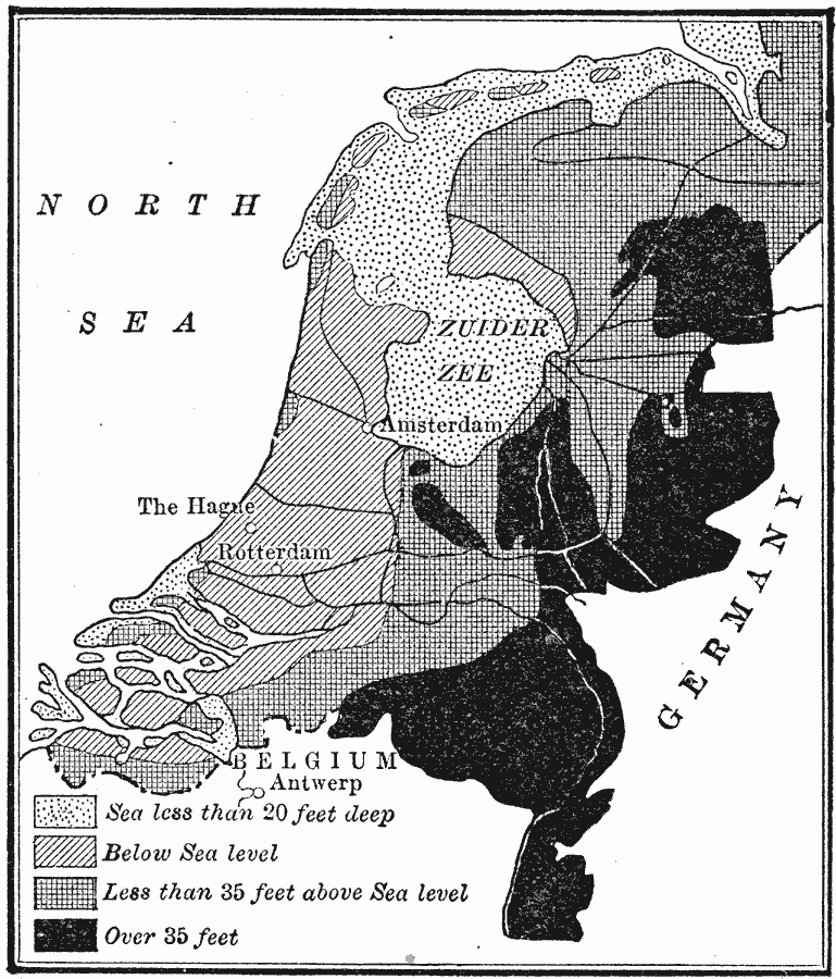
Description: A map of the Netherlands in 1910 showing general elevations and the portions of land below sea level. The map shows water depths of the Zuider Zee less than 20 feet deep, the lands below sea level, areas less than 35 feet above sea level, and areas above 35 feet. The map shows Amsterdam, Rotterdam, and The Hague.
Place Names: Netherlands, Amsterdam, �Rotterda
ISO Topic Categories: oceans,
location,
inlandWaters
Keywords: The Portion of the Netherlands that is below Sea Level, hydrological, water depths, oceans,
location,
inlandWaters, Unknown, 1910
Source: Ralph S. Tarr, B.S., F.G.S.A. and Frank M. McMurry, Ph.D., New Geographies (Second Book) (New York , NY: The MacMillan Company, 1910) 277
Map Credit: Courtesy the private collection of Roy Winkelman |
|
