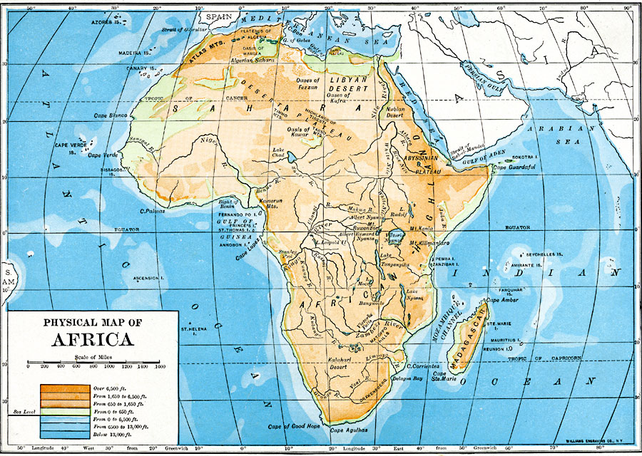
Description: A physical map of the African continent showing general color coded land elevations and water depths. This map shows rivers and prominent landform features, including highland regions, plateaus, mountains, and desert oases.
Place Names: A Complete Map of Africa, Abyssinia, �Algeria, �Anglo-Egyptian Sudan, �Angola, �Congo, �Egypt, �Ethiopia, �Johannesburg, �Kamerun, �Kongo, �Libya, �Madagascar, �Morocco, �Nigeria, �Rhodesia, �Somalia, �Sudan, �Tripoli, �Uganda, Plateaus of Algeria, Oasis of Wargla, Oases of Fezzan, Oases of Kufra, Highlands of Tibesti, Oasis of Kawar, Abyssinian Plateau, Bight of Benin, Mt. Ruwenzori, Mt. Kenia, Mt. Kilimanjaro, Victoria Falls, Matoppo Hills, Drakensberg, Cape Agulhas
ISO Topic Categories: oceans,
location,
inlandWaters,
elevation
Keywords: Physical Map of Africa, physical, kRelief, topographical, oceans,
location,
inlandWaters,
elevation, Unknown, 1910
Source: Ralph S. Tarr, B.S., F.G.S.A. and Frank M. McMurry, Ph.D., New Geographies (Second Book) (New York , NY: The MacMillan Company, 1910) 372
Map Credit: Courtesy the private collection of Roy Winkelman |
|