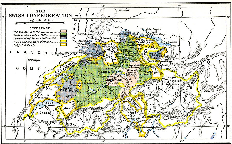
Description: A map of Switzerland during its expansion period from 1481 to 1515. This map is color–coded to show the original three cantons (Schwyz, Unterwalden, and Uri) formed under the Federal Charter of 1291, the cantons added before 1481 (Lucerne, Zürich, Berne, Glarus, and Zug) to form the Acht Orte (eight cantons), and the cantons added between 1481 and 1515 (Fribourg, Solothurn, Basel, Schaffhausen, and Appenzell) to form the Dreizehn Orte (thirteen cantons) of the Swiss Confederacy. The map also shows the allied and protected districts, and the subject districts around the Confederation.
Place Names: Switzerland, Basel, �Bern, �Freiburg, �Fribourg, �Geneva, �Lausanne, �Luzern, �Zuric
ISO Topic Categories: oceans,
location,
inlandWaters
Keywords: The Swiss Confederation, historical, �political, country borders,
major political subdivisions,
local jurisdictions, other military, oceans,
location,
inlandWaters, Unknown, 1481–1513
Source: Ward, Prothero, and Leathes, The Cambridge Modern History Atlas (New York, NY: The Macmillan Company, 1912)
Map Credit: Courtesy the private collection of Roy Winkelman |
|