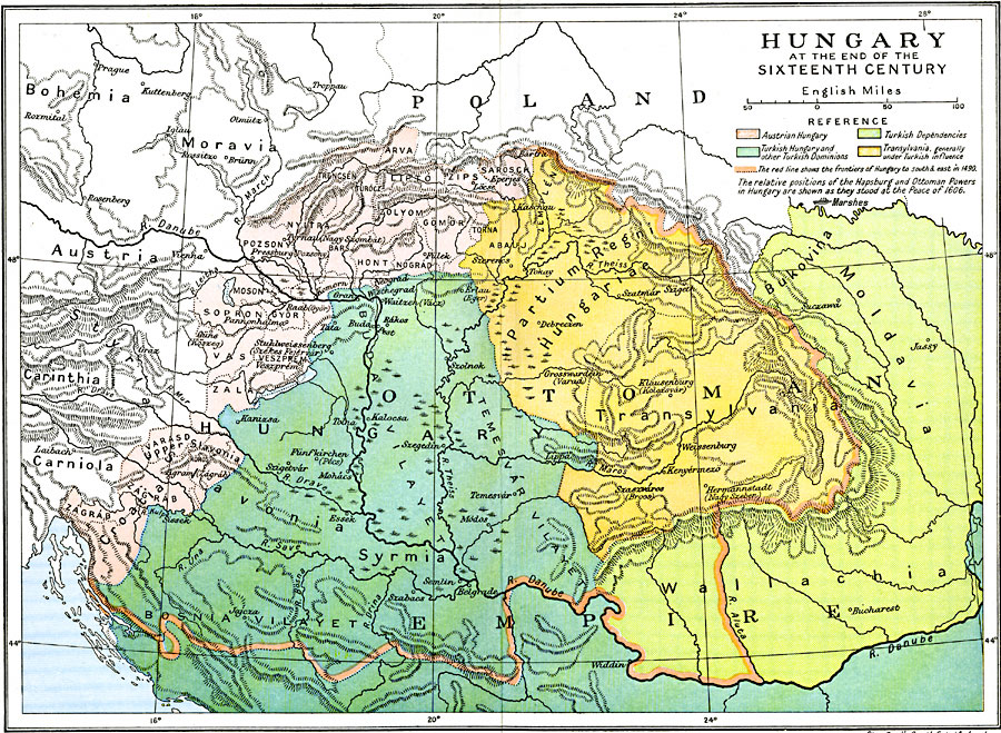
Description: Map of Hungary at the end of the sixteenth century. Map is color–coded to show various claims made on this land including the frontiers of Hungary in 1490 and the relative positions of the Hapsburg and Ottoman powers in Hungary as they stood at the Peace of 1606, including Austrian Hungary, Turkish Hungary, Turkish dependencies, and Transylvania under Turkish influence. The map shows major cities, some with variations such as Pressburg (Pozsony) and Grosswardein (Varad), major rivers, marshes, and mountain systems.
Place Names: Hungary, Austria, �Bosnia, �Hungary, �Moldavia, �Ottoman Empire, �Poland, �Transylvani
ISO Topic Categories: oceans,
location,
inlandWaters,
boundaries
Keywords: Hungary at the End of the Sixteenth Century, political, country borders,
major political subdivisions,
local jurisdictions, oceans,
location,
inlandWaters,
boundaries, Unknown, 1490–1606
Source: Ward, Prothero, and Leathes, The Cambridge Modern History Atlas (New York, NY: The Macmillan Company, 1912)
Map Credit: Courtesy the private collection of Roy Winkelman |
|