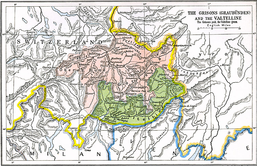
Description: A map of the Grisons (Graubünden Canton) and the Valtelline territories of Switzerland in 1622. The map is color–coded to show the area of the Grisons in pink and the Valtellines (now part of the Lombardy region of Italy) in green. This map refers to the period of Henry IV of France, who occupied the Valtelline region and the important pass between Milan and Tyrol.
Place Names: Switzerland, Italy, �Milan, �Switzerland, �Venic
ISO Topic Categories: oceans,
location,
inlandWaters,
boundaries
Keywords: The Grisons (Graubunden) and the Valtelline, political, �local jurisdictions,
country borders, oceans,
location,
inlandWaters,
boundaries, Unknown, 1622
Source: Ward, Prothero, and Leathes, The Cambridge Modern History Atlas (New York, NY: The Macmillan Company, 1912)
Map Credit: Courtesy the private collection of Roy Winkelman |
|