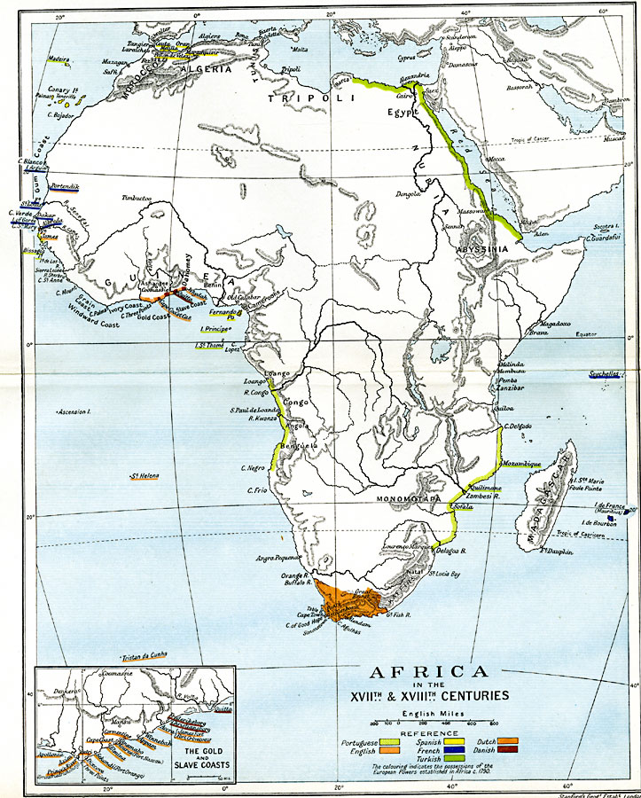
Description: Map of Africa in the 17th & 18th centuries. This map is color–coded to show the possessions of European powers established in Africa, circa 1790, including Portuguese, English, Spanish, French, Dutch and Danish claims, and the Turkish Ottoman claims along the eastern Mediterranean and Red Sea coastline. The map shows major cities, trade centers, and ports, as well as major rivers and mountain systems. An inset map details the European claims along the Gold Coast and Slave Coast.
Place Names: A Complete Map of Africa, Abyssinia, �Algeria, �Cape Town, �Congo, �Egypt, �Guinea, �Madagascar, �Morocco, �Tripol
ISO Topic Categories: oceans,
location,
inlandWaters,
boundaries
Keywords: Pre-Colonial Africa, political, local jurisdictions,
country borders,
major political subdivisions, oceans,
location,
inlandWaters,
boundaries, Unknown, 17th and 18th Centuries
Source: Ward, Prothero, and Leathes, The Cambridge Modern History Atlas (New York, NY: The Macmillan Company, 1912)
Map Credit: Courtesy the private collection of Roy Winkelman |
|