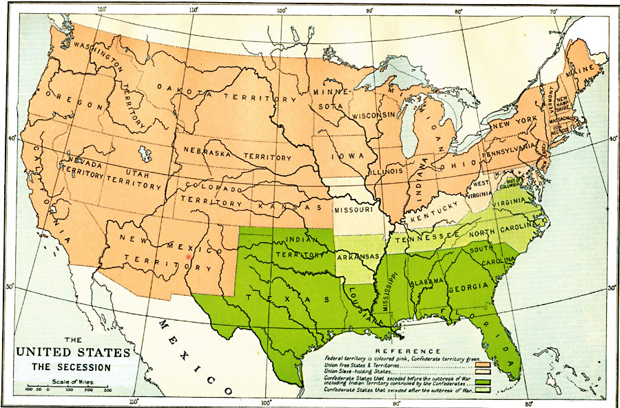
Description: A map showing the secession of the Confederate States from the Union, from the secession of South Carolina (December 20, 1860) to the secession of Tennessee (June 8, 1861). The map is color–coded to show the Federal States and territory (including the Union slave–holding States of Missouri, Kentucky, West Virginia, Maryland, and Delaware), and the Confederate States and territories. The map indicated those States and Indian Territory that seceded before April 15, 1861, and those that seceded after the outbreak of the war (Arkansas, Tennessee, Virginia, and North Carolina).
Place Names: Civil War, Dakota Territory, �Florida, �Louisiana, �Nevada, �New Mexico, �Oregon, �Texas, �United States, �Utah, �Washington, �Confederate territory, �slave states, �free states, �Slaver
ISO Topic Categories: oceans,
location,
inlandWaters,
boundaries
Keywords: The United States Secession, political, �historical, local jurisdictions,
country borders,
major political subdivisions, historical event, oceans,
location,
inlandWaters,
boundaries, Unknown, 1860–1861
Source: Ward, Prothero, and Leathes, The Cambridge Modern History Atlas (New York, NY: The Macmillan Company, 1912)
Map Credit: Courtesy the private collection of Roy Winkelman |
|
