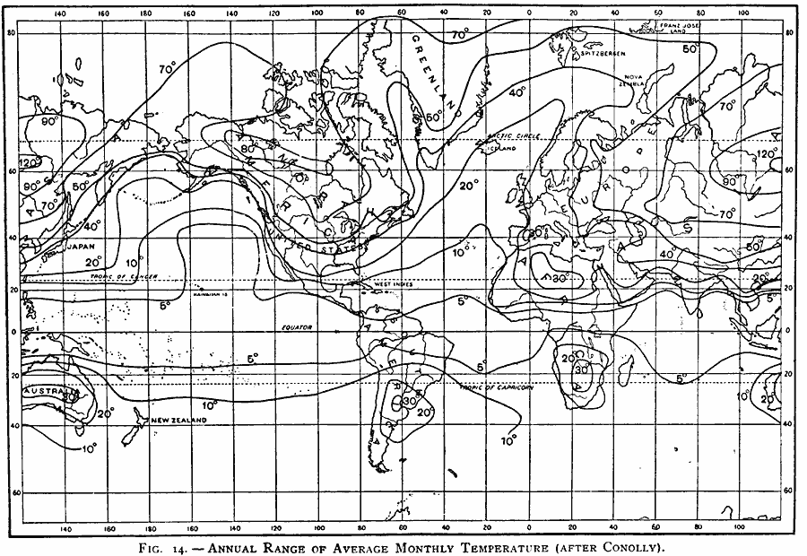
Description: A map of the Earth from 1896, showing the global annual range of average monthly temperature from cool months to warm months. Isotherms delineate areas of temperature fluctuations, where, for example, in central Australia, there is a 30 degree difference between the coldest month and the hottest, whereas in Siberia, there can be a 120 degree difference.
Place Names: A Complete Map of Globes and Multi-continent, Africa, �Antarctica, �Asia, �Australia, �Europe, �North America, �South Americ
ISO Topic Categories: inlandWaters,
location,
oceans,
climatologyMeteorologyAtmosphere
Keywords: Global Annual Temperature Range, physical, �meteorological, kClimate, physical features, temperature, inlandWaters,
location,
oceans,
climatologyMeteorologyAtmosphere, Unknown, 1896
Source: Frank Waldo, Elementary Meteorology (New York, New York: American Book Company, 1896) 62
Map Credit: Courtesy the private collection of Roy Winkelman |
|