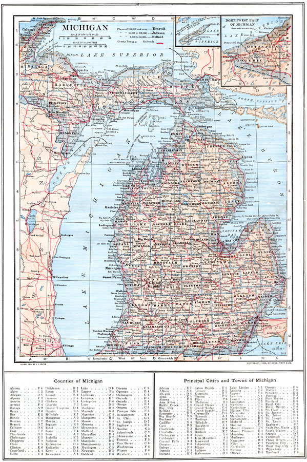
Description: A map from 1909 of Michigan showing the capital city of Lansing, major cities and towns, railroads, rivers, and lake shoreline. An inset map shows the northwestern continuation of the Upper Peninsula with a detail of Isle Royale. A grid reference at the bottom of the map lists counties, principal cities, and towns of Michigan.
Place Names: Michigan, Detroit, �Battle Creek, �Grand Rapids, �Saginaw, �Flint, �Jackson, �Pontiac, �Kalamazoo, �Lansing, �Nile
ISO Topic Categories: boundaries,
location,
inlandWaters,
transportation
Keywords: Michigan, physical, �political, �transportation, physical features, county borders, railroads, boundaries,
location,
inlandWaters,
transportation, Unknown, 1914
Source: , The New Encyclopedic Atlas and Gazetteer of the World (New York, NY: P. F. Collier and Son, 1914) 29
Map Credit: Courtesy the private collection of Roy Winkelman |
|