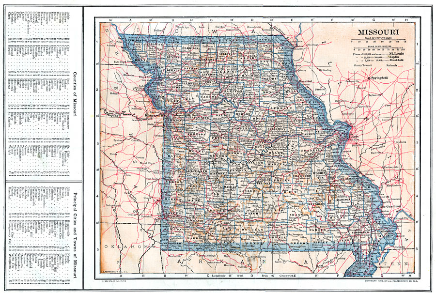
Description: A map from 1914 of Missouri showing the capital of Jefferson City, counties and county seats, major cities and towns, railroads, and rivers. A grid reference in the margins of the map lists counties, principal cities, and towns of Missouri.
Place Names: Missouri, Jefferson, �St. Joseph, �Hannibal, �Kirksville, �Lexington, �Neosho, �Springfiel
ISO Topic Categories: boundaries,
inlandWaters,
location,
transportation
Keywords: Missouri, physical, �political, �transportation, physical features, county borders, railroads, boundaries,
inlandWaters,
location,
transportation, Unknown, 1914
Source: , The New Encyclopedic Atlas and Gazetteer of the World (New York, NY: P. F. Collier and Son, 1914) 32
Map Credit: Courtesy the private collection of Roy Winkelman |
|