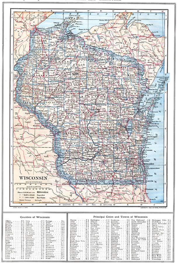
Description: A map from 1914 of Wisconsin showing the capital, Madison, counties and county seats, Indian reservations, principal cities and towns, railroads, lakes, rivers, and shoreline. A grid reference at the bottom of the map lists counties, principal cities, and towns of Wisconsin.
Place Names: Wisconsin, Milwaukee, �Asland, �Wausau, �Racine, �Madison, �Oshkosh, �La Crosse, �Appleton, �Beloit, �Mineral Poin
ISO Topic Categories: boundaries,
inlandWaters,
location,
transportation
Keywords: Wisconsin, physical, �political, �transportation, physical features, county borders, railroads, boundaries,
inlandWaters,
location,
transportation, Unknown, 1914
Source: , The New Encyclopedic Atlas and Gazetteer of the World (New York, NY: P. F. Collier and Son, 1914) 54
Map Credit: Courtesy the private collection of Roy Winkelman |
|