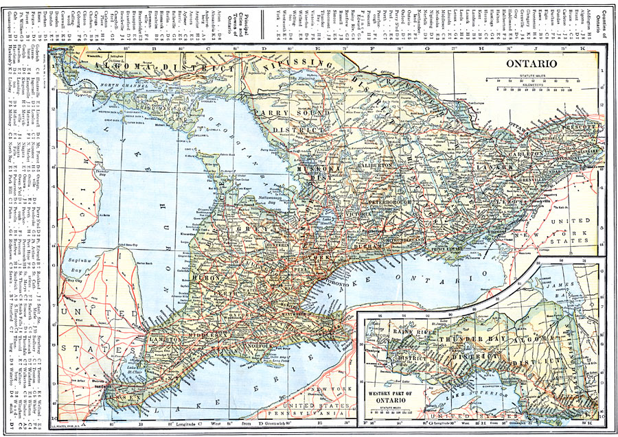
Description: A map from 1914 of the province of Ontario with an inset map of the western part of the province. The map shows the Canadian capital of Ottawa, the province capital of Toronto, county boundaries, major cities and towns, railways with connections to the railway network of the United States, and the lakes and rivers of the province. A grid–key in the margins references the locations of principal cities and towns, and the counties and divisions of Ontario.
Place Names: Canada, Ottawa, �Toronto, �Port Arthur, �Port Huron,
ISO Topic Categories: boundaries,
inlandWaters,
location,
transportation
Keywords: Ontario, physical, �political, �transportation, physical features, county borders,
country borders, railroads, boundaries,
inlandWaters,
location,
transportation, Unknown, 1914
Source: , The New Encyclopedic Atlas and Gazetteer of the World (New York, NY: P. F. Collier and Son, 1914) 58
Map Credit: Courtesy the private collection of Roy Winkelman |
|