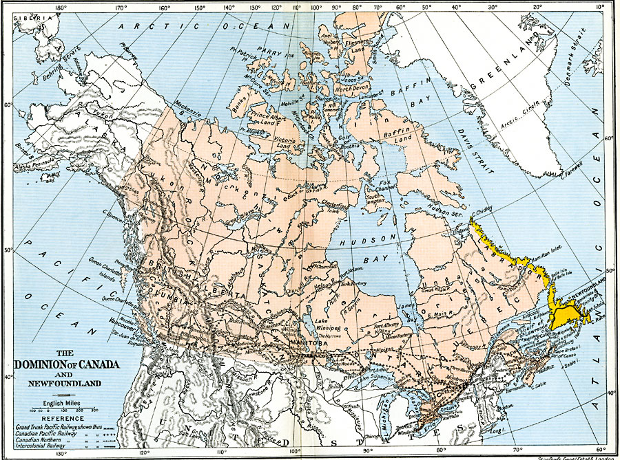
Description: A map from 1912 of the Dominion of Canada and Newfoundland (Newfoundland and Labrador did not become a province of Canada until 1949). The map shows the province boundaries at the time, major cities and towns, mountain systems, rivers, coastal features, and islands. The map shows the railway routes of the Grand Trunk Pacific Railway, Canadian Pacific Railway, Canadian Northern, and Intercolonial Railway, and the connecting lines to the railway network in the United States.
Place Names: Canada, Canada, �Newfoundlan
ISO Topic Categories: oceans,
location,
inlandWaters,
boundaries
Keywords: The Dominion of Canada and Newfoundland, political, �transportation, country borders,
local jurisdictions,
major political subdivisions, railroads, oceans,
location,
inlandWaters,
boundaries, Unknown, 1912
Source: Ward, Prothero, and Leathes, The Cambridge Modern History Atlas (New York, NY: The Macmillan Company, 1912)
Map Credit: Courtesy the private collection of Roy Winkelman |
|