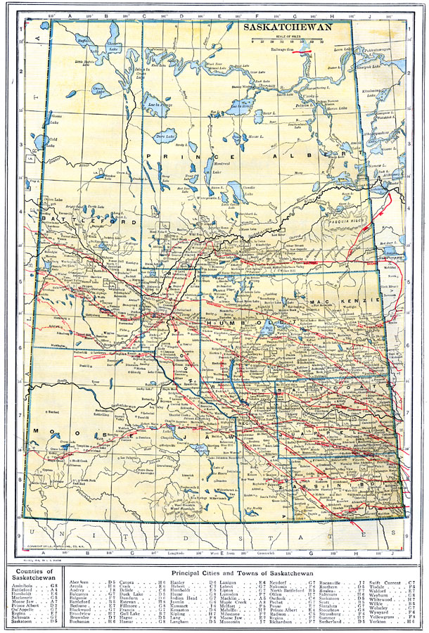
Description: A map from 1914 of the province of Saskatchewan, showing the provincial capital of Regina, county boundaries, major cities and towns, Indian reservation lands, railways, terrain features, lakes, and rivers. A grid–key in the margins references the locations of principal cities and towns, and the counties and divisions of Saskatchewan.
Place Names: Canada, Moose Jaw, �Regina, �Saskatoon, �Prince Albert, �Battleford,
ISO Topic Categories: boundaries,
inlandWaters,
location,
transportation
Keywords: Saskatchewan, physical, �political, �transportation, physical features, county borders, railroads, boundaries,
inlandWaters,
location,
transportation, Unknown, 1914
Source: , The New Encyclopedic Atlas and Gazetteer of the World (New York, NY: P. F. Collier and Son, 1914) 60
Map Credit: Courtesy the private collection of Roy Winkelman |
|