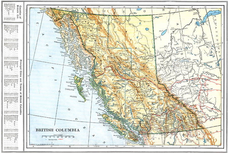
Description: A map from 1914 of British Columbia showing the provincial capital of Victoria, major cities and towns, railway lines, mountains, lakes, rivers, coastal features, and islands. The map is color–coded to show terrain features, with highlands and mountain systems in buff tints, and coastal lowlands in green. A grid–key in the left margin locates counties and principal cities and towns of British Columbia.
Place Names: Canada, Vancouver, �Victoria, �Queen Charlotte Islands,
ISO Topic Categories: boundaries,
location,
inlandWaters,
oceans,
transportation
Keywords: British Columbia, physical, �political, �transportation, physical features, county borders, railroads, boundaries,
location,
inlandWaters,
oceans,
transportation, Unknown, 1914
Source: , The New Encyclopedic Atlas and Gazetteer of the World (New York, NY: P. F. Collier and Son, 1914) 62
Map Credit: Courtesy the private collection of Roy Winkelman |
|