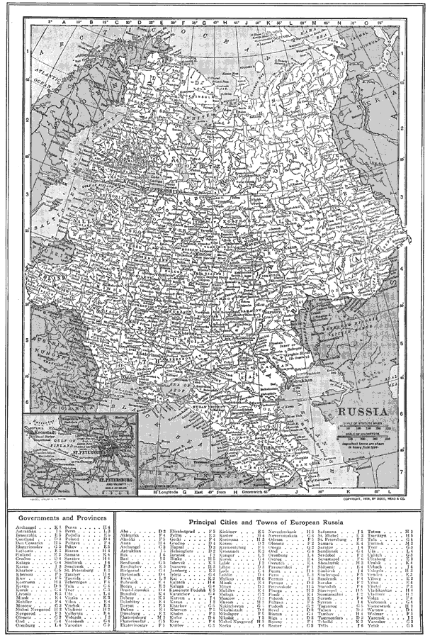
Description: A map from 1914 of European Russia at the time. The map shows province boundaries, major cities, towns, and ports, railroads, lakes, rivers, and terrain. An inset map details the area around St. Petersburg on the Gulf of Finland. A grid–reference key at the bottom of the map shows the locations of the provinces and principal cities and towns of European Russia.
Place Names: Russia, Saint Petersburg, �Kazan, �Mosco
ISO Topic Categories: boundaries,
inlandWaters,
location,
oceans
Keywords: Russia, physical, �political, physical features, country borders, boundaries,
inlandWaters,
location,
oceans, Unknown, 1914
Source: , The New Encyclopedic Atlas and Gazetteer of the World (New York, NY: P. F. Collier and Son, 1914) 140
Map Credit: Courtesy the private collection of Roy Winkelman |
|