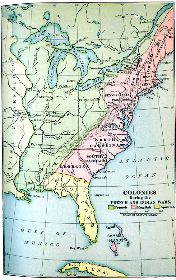
Description: A map of eastern North America at the time of the French and Indian War (1754–1763). The map is color–coded to show the possessions of the British, French, and Spanish at the time. The map shows the British colony boundaries, major cities, forts, and settlements, terrain, lakes, rivers, and coastal features.
Place Names: Early America 1400-1800, Boston, �Charleston, �Jamestown, �Savannah, �St. Augustine, �French and Indian War, �Colonial Americ
ISO Topic Categories: oceans,
location,
inlandWaters
Keywords: Colonies During the French and Indian Wars , historical, �political, local jurisdictions, other military, oceans,
location,
inlandWaters, Unknown, 1754–1763
Source: Jacques W. Redway, F.R.G.S., The Redway School History (New York, NY: Silver, Burdett and Company, 1911)
Map Credit: Courtesy the private collection of Roy Winkelman |
|